Tirion Double-Sided Multi-Latitude Planisphere
All pricing in USD
Description
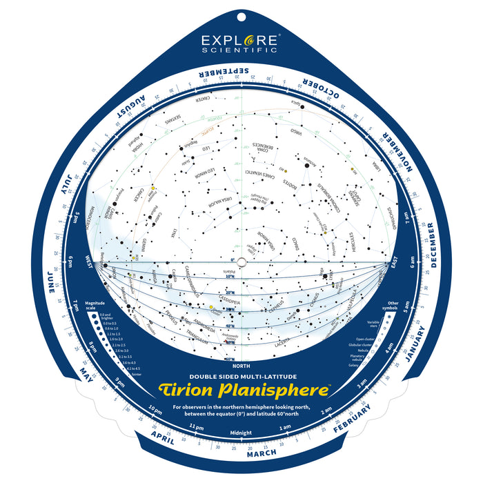
With a universe of options to explore, it can be difficult to track what awe-inspiring treasures are currently visible in your sky. The Tirion double-sided planisphere can help guide your explorations throughout the year. Created by noted celestial cartographer Wil Tirion, this planisphere works over a vast range of northern hemisphere latitudes and uses a double-sided design to minimize distortion. It is made of durable plastic and the celestial dials are secured with no-corrosion brass rivets.
About Wil Tirion
Based in The Netherlands, Tirion has been crafting stars maps since the 1970s and became a professional uranographer shortly after the publication of his highly regarded Sky Atlas 2000.0 in 1981.
Video
How To Use
How To Use the Tirion Planisphere:
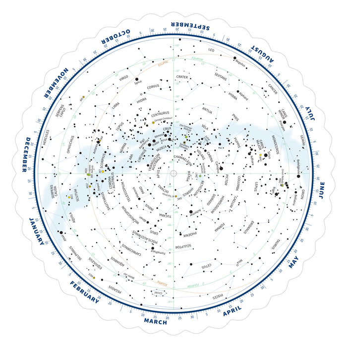
Turn the upper sheet so that the appropriate local time and the date match. If the clock is set to daylight saving time, subtract one hour from the time on your watch. This side of the planisphere then shows the stars and constellations that are visible above the southern horizon and the other side shows what is visible above the northern horizon. On both sides a number of different horizon lines are shown, labeled with the latitude. Choose the horizon line that is closest to your latitude. So, if you live at latitude 37°N, the best choice is the horizon line for 40°N. If you live on 32°N, use the horizon line for 30°N. Notice that the horizon lines on this side (looking South) run from 60°N (top) to 0° (bottom), while on the reverse side it is the other way around.
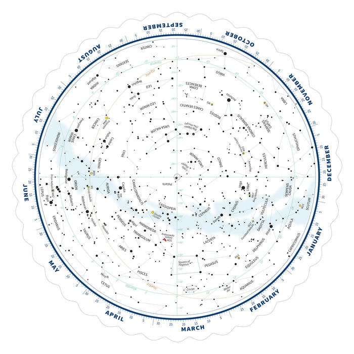
On any polar centered projection, used on planispheres, there is a lot of distortion, especially near the edges of the map. That is why we created this double sided planispheres. It keeps the distortion to a minimum. Constellations outside the equator (the green circle) are shown with less distortion on the other side of this planisphere.
The brown dashed line is the ecliptic, the yearly path of the sun amongst the stars. The bright planets (Mercury, Venus, Mars, Jupiter and Saturn) are always near the line, so if you see a bright ‘star’ close to the ecliptic, that is not shown on the map, you can be sure it is one of these planets.
The faint blue band on the maps is the Milky Way. On the southern map (this side) you can see two small clouds; the SMC (Small Magellanic Cloud) and the LMC (Large Magellanic Cloud). These are small galaxies that are considered to be satellites of our own Milky Way Galaxy.
Tirion’s planisphere also uses symbols to identify select stars and deep sky objects like galaxies, nebulae and clusters.
CA Residents: Prop 65 WARNING(S)


